Present Water System

...now browsing by category


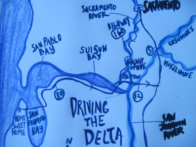
Driving the Delta

Friday, September 10th, 2010

“If it keeps on raining, the levee’s going to break.”

– Led Zeppelin

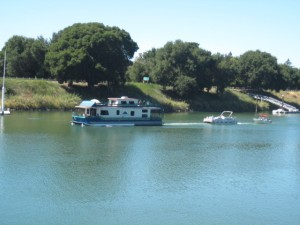
houseboat on the Delta

Took a drive through the Delta the other day. It was a beautiful drive, complete with picturesque houseboats floating down the Sacramento, sultry heat, and strawberry popsicles.  I let myself soak up the delicious end-of-summer day. But, a part of me was confused.

The fly in my ointment: a part of me that couldn’t reconcile what I imagined the Delta would look like and what it looks like in reality. I had been looking at pictures and reading definitions and trying to understand what I might see. You were there with me, dear reader, as I was piecing it together in my intro to the Delta last week.

The thing is, I know the Delta is in trouble. All those things we talked about last week- lack of water going through the Delta, its fragile ecosystem. But I still had in my mind, a mixture of bigger and smaller marshy waterways that were disturbed and had less water in them than they should, but that still looked like a Delta. And that’s not what I saw.
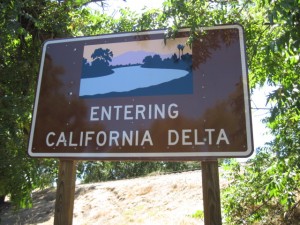
It’s not all bad. Not at all. It was impressive to see how humans can shape and utilize the environment to our benefit. Humans have turned the Delta into a carefully constructed agricultural and recreational paradise, as well as the central piping that gets water down South. The Delta’s fertility (due to river sediment) makes it the perfect place for farming. Except for all that water. But if you can control the water, then you not only have the perfect soil, but a water source with which to grow things.  And, the large channels happen to be perfect for boating and watersports.

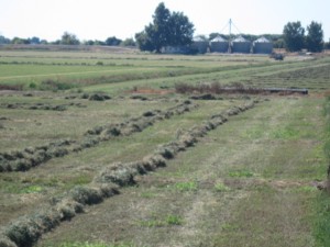
Delta farmland

In this man-altered Delta, the Sacramento River moves along in a manmade-looking channels. Big waterways connect with little waterways- aqueducts and ditches- all manmade. On the side of the waterways, farmland stretches for miles. Farmland that is sunken, most of the time, lower than the waterway next to it. Fields surrounded by raised earthen walls- levees. The levees keep the water out and help organize the gigantic effort to get water to where its needed.

All day long, we drove on levees- where all the roads run. With sunken farmland to one side and canals of water on the other. Passing signs for Brannan Island- an island without water around it. And most surprisingly, not passing wetlands, except for a few small patches.  While I’m sure it was partially the route we took, I am still surprised at what I saw. What people call the Delta doesn’t resemble a delta in any way.

It’s a pretty place on the surface. There are a ton of fun things to do. Boating and

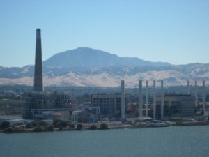
crossing Suisun Bay

water sports, fishing and relaxing, sunbathing and drinking beer.  But if you look at the Delta a little deeper, the precariousness of its current nature becomes apparent.

The effort it takes to maintain an area that should be underwater is one piece of this. Not only is it farmers who have to maintain their levees, most of the population of Sacramento would be underwater if it weren’t for the constant struggle to keep water out.  Reading newspaper headlines, you’ll get a sense that the other levee that threatens to break is the fight over how water that moves through the Delta should be used.

Pumping plants northwest of Tracy, California suck water from the Delta and into a series of canals that deliver the water to urban areas in Southern California as well as to farms in the Central Valley. There is only so much water and we have allocated Delta water to its limit.

You can imagine that with all this human activity organizing, controlling, and siphoning off water from the Delta, that it is not in good shape ecologically. The animals that call the Delta their home have had to rearrange their lives around our uses, many brought to the brink of extinction- salmon and Delta smelt among them.  And the functions the Delta had, as a major wetland, have almost come to a complete stop.

Driving the delta, I saw what a productive place we’ve created, and at the same time, felt the darker, imminent threat of the many levees that hold the Delta up, physically, socially, and ecologically close to breach.

San Francisco Waterways: Lobos Creek

Thursday, June 3rd, 2010

“With a resolute whisper, Lobos Creek flowed past our home on its mile-long journey to the ocean. It was bordered, at times covered with watercress and alive with minnows and tadpoles, and variety of larvae. In the spring, flowers were rampant and fragrant. In heavy fog, the creek was eerie, rippling out of nowhere and vanishing into nothingness.”

– Ansel Adams, 1985

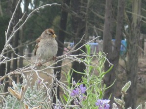
a cute Zonotrichia leucophrys

I couldn’t believe it. The last free-flowing creek in San Francisco and I hadn’t heard about it before? Lobos Creek. The primary water source for the Presidio. Flowing from within the Presidio’s federal borders, slowly fed by springs, its mouth at Baker Beach. I had to pay a visit.

Excited for a nice creek-side walk, I chose the Lobos Creek Dunes trail- which even had a little mini interpretive trail that included stops by the creek . As I began my stroll along the boardwalk, amid little rolling hills covered in low lying shrubbery- sprays of red and orange flowers here and there- I saw what looked like a river valley lined by a fence. And figured that the fence would open up somewhere for a good view of the creek. When we got to Number 2 on the interpretive trail, the stop marked “A Creek in the City,” there was a bench next to the barbed wire fence. And if I squinted real hard, I could see about a three-foot stretch of flowing water. He he. Some creek trail.

Undaunted, I continued to walk through the beautiful landscape. I’d find the creek in a bit. But I wanted to appreciate

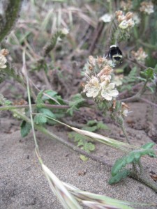
bumble bee cruising the dunes

the strange land I found myself in. Near a few buildings with Monterey cypress standing guard behind them, the Lobos Creek Dunes area is clear of trees, just small rolling hills. I wondered when the stark sand dunes would come. And then, I realized these were the dunes. Small rolling sand hills with all sorts of beautiful little plants covering them.

The foghorn sounding its low tuba, rumbling under my feet. Waves echoing softly behind me. White-crowned sparrows flitting low from bush to bush singing.  A red-tailed hawk screeching. I found myself in a landscape that was part of the larger dune ecosystem that covered half of San Francisco before 1776.

Thanks to the thoughtful and thorough restoration that the Presidio and a community of volunteers did, the area gives you an idea of what much of San Francisco must have looked and felt like. Salty. Foggy. Pink flowers glowing from their carpet of leaves. Windy. Orange Sticky Monkey flowers. Coast buckwheat. Only there were grizzly bears and bobcats roaming among the dunes too.

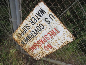
After I’d satiated myself watching bees and sparrows do their thangs, I decided to find the creek. And probably do some climbing and scrambling just to get there. I guess the Feds are protective of their water.

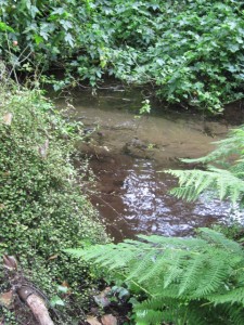
I walked along Lincoln Way and saw a tiny arm of creek. Climbed down an embankment with a little trail to get closer and found what looked to be a pump station on the creek. Winding my way through cypress trees stitched with lacy green leaves, I kept along the course of the creek, at this point five-feet across. The roar of the ocean got closer. For a couple hundred feet, I lost sight of the river, with another barbed wire fence just to my right and thick bushes inches to my left. I squeezed through and pushed on.

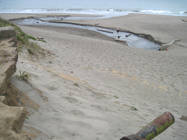
A glimpse of waves. I picked up my pace along the fence. The ground dissolved into soft sand. And I was there- at the beach- Lobos Creek winding its small self down into the Pacific.

Thank you to Found SF for alerting me to Lobos Creek. For great historical pictures of rivers and San Francisco, visit their site here and go on a virtual SF water tour.

Roadtrip to SoCal: Coachella and the Salton Sea

Thursday, May 13th, 2010

Coachella Valley

Driving from Palm Desert south along Highway 111, the palm trees swaying lusciously in the breeze, spouting fountains announcing the newest gated community, the green of golf courses stretching practically to the horizon, you’d never know that you were in a desert. Except, of course, for the heat.

Like much of our relationship with water in California, our relationship to this southern desert is no exception in its strangeness. For almost a century, we have been fascinated by the desert’s possibilities- a climate where, if you can get water to it, fruits, vegetables, and dates grow all year long, a climate where you can live in eternal summer (except in the real summer when you live in the Eternal Oven.)

Thanks to water piped in from the Colorado River and water from deep below the surface of the desert, the desert is a fantasy resort town and agricultural hot-spot, flaunting fountains, ponds, and verdant greenery. But around the small habitable island of our creation, is still the desert. A constant reminder of the fragility of life in these parts, of the constant struggle for water.

Driving through the Palm Desert, I was struck by my tendency to think of water more often. To make sure I knew where I’d be able to get a drink next. As if the mirage around me, with its gas stations and

desert irrigation

grocery stores, didn’t quite fool my body into trusting it. The dry heat bearing down, leaching my water away.

If you look at the native plants of the area, you understand that to survive in the desert, one has to be the Most water efficient. To take advantage of water when it comes, and to ration water as if you may never see it again.

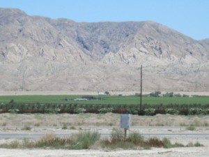
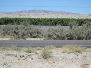
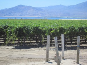
We have changed all that. Outside of the resort town, the Coachella Valley stretched in front of us- lush, green agriculture sandwiched between parched rocky mountains and cracked tumble week desert.

The Salton Sea

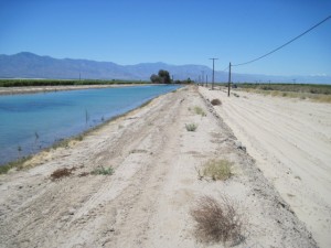
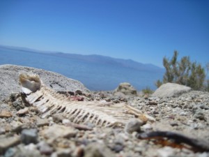
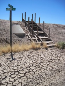
As we approached the Salton Sea, rows of green crops stretched between the highway and the sea, bordered by  dust and small canals of irrigation water. By the time we were cruising the sea’s eastern border, we had again entered what seemed to be barren desert with the occasional sign of human settlement, skeletons of old trailers and armchairs.

The Salton Sea’s story is a very interesting one, one that would not have unrolled as it did without the help of humans. The Sea used to be an area called the Salton Sink, a low-lying desert basin with a high amount of salt in its soil, which would occasionally fill with freshwater from the Colorado River and then evaporate again as part of a natural process over hundreds of thousands of years. In 1905, settlers in the West had begun to try to tame the Colorado River by building canals and dikes to divert water for agriculture. That year, after heavy rain and snowmelt, the river breached the Alamo Canal and other dikes, creating two new rivers, and pouring all of itself into the Salton Sink, creating the Salton Sea within two years.

Now 376 square miles, its salinity higher than the ocean’s, the sea is fed only by agricultural run-off water. In a strange twist of fate, with the development on the Southern California coast displacing thousands of migrating birds, the Sea has become a bird sanctuary. Though with rising salinity levels as a result of not enough water coming into the sea to replace water evaporated, birds might not be able to use the Sea as a resting place for many more years. If you want to learn more about the effort to preserve the Salton Sea as a place for bird migration, read here.

In terms of human development, since its creation in 1905, the Sea has gone through a few waves of developers trying to market it as a resort spot, hence the remaining trailer parks and more often, the wreckage of past habitation. Funnily enough, my grandpa mistakenly bought two lots at the side of the Sea during one of the resort booms. Unfortunately for him, the Sea has never retained a large population, and he had to sell his lots.

two inch magical plant world

Our favorite thing

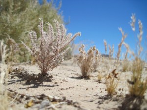
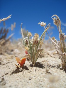
My favorite moment of the drive down the Salton Sea was stepping out of the truck to take a few pictures of an abandoned café, when my mom and I noticed thousands of little plants at our feet. It is easy for us humans to think, when we take a quick look at the desert, that it is empty. But at our feet, were thousands of plants, mostly two to four inches high- some flowering, some succulents, many with different colors- green, red, yellow. These are the plants that call the desert home.

Moving forward it would be wise to acknowledge the beauty of the desert and learn from its native inhabitants how to adapt to a given climate. To stop and look for a second more, using human know-how and technology to work with nature, rather than try to dominate it, to understand and learn, rather than continue our knee-jerk altering without seeing the desert’s many gifts to us.

Miller Creek Restoration

Thursday, March 25th, 2010

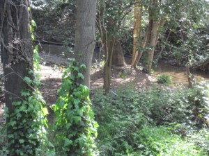
Miller Creek hidden in English Ivy

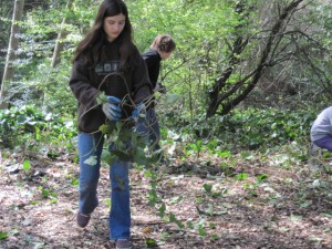
On a sunny morning this week, we pulled up to a thin walkway, between suburban houses, that entered the cool shade of Miller Creek. Located just off the 101 off Lucas Valley Road in Marin County, at this reach in its meanderings, Miller Creek and its riparian corridor pass just behind a school. Soon, sixth graders from Miller Creek Middle School would pour out of class and into the trees behind their school to continue a tradition of restoring and taking care of their local creek.

A collaboration between Marin County Stormwater Pollution Program (MCSTOPP) and Students and Teachers Restoring A Watershed (STRAW), these creek restoration days are the hands-on part of an educational effort to connect “riparian restoration concepts to stormwater pollution prevention and to creek habitat protection.” After in-class learning, the students come to the creek to remove invasive plants, non-native plants that aggressively take-over other plants’ habitats, to plant native plants that will provide habitat for animals and prevent erosion, and to stabilize creek walls.

The night before coming to Miller Creek, I read up on stormwater pollution and riparian restoration and learned some interesting facts. The most enlightening was that preventing stormwater pollution is especially important because almost all stormwater leads directly to creeks, the Bay, and the ocean. Water that goes down a drain in your house goes to a treatment plant before entering a natural body of water. Not stormwater. In other words, any litter, chemicals, or soap that go into the gutter, go into your local creeks and the ocean. So, it is super important to prevent anything but pure stormwater from flowing into storm drains.

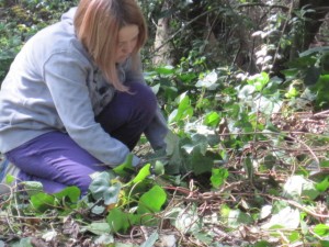
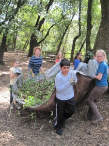
As the first classes poured into the trees, the sixth graders were split up to work on different projects. My colleague Vivien, who works with MCSTOPP, and I led our first group of eight students to a clearing upstream of the other groups. English Ivy, an invasive plant that is home only to rats, and is so noxious that no animals eat it, covered the area. Vivien instructed the students to kneel on the ground and slowly and carefully pull the Ivy from the ground, trying to get as much of the root as possible so that it wouldn’t return. He then demonstrated how to use two tools, a weed-puller and a mattock, a small pick, that would help yank the roots of any stronger plants up. And then he set us loose.

Sounds easy enough right? During that first group I got an idea of why English Ivy is an invasive plant. An interconnected tangle of plants that roots its branches wherever it can and can have its main root yards away from the ends of its vines, I could see why they instruct the kids to be slow and careful about work. My first instinct was to attack and rip at the tangled monstrosity of plants in front of me. Just trying to find where a branch went into the ground was challenging. But reigning in my impatience and wanting to be a good roll-model, I figured out a method of pulling that seemed to be most effective. Patience. Working with what’s right in front of you. Being content with removing one small root at a time.

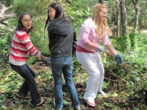
Throughout the day, Vivien and I worked with five different groups of sixth-graders, watching as the Ivy’s borders retreated. At the end of the day, the truck was filled with around three cubic yards of Himalayan blackberry and Ivy from everyone’s effort. It was rewarding work.  And especially rewarding to watch different students work together to get massive trunks of Ivy from the ground. My personal favorite was watching as a group of girls, a few of them in pretty slip-on shoes and pink flip-flops hunkered down in the dirt, using their collective strength to pull out branches of Ivy we’d been having trouble with all day long. It was a joy to watch a small group of humans band together to take care of the environment, to be connected to it.

As I watched five different groups of kids approach the mass of Ivy in the same way I had (wanting to rip through the tangle impatiently and play tug-of-war with long vines that would break without giving their roots up), I began to see Ivy as the perfect metaphor for humans’ relationship with the environment at the moment. An interconnected tangle of problems that will not take a quick fix, the Ivy, like our ecosystem problems, requires patience, working with what is right in front of us, satisfaction with small victories, and a commitment to removing the root of the problem, not ripping at branches haphazardly and mindlessly. One Ivy root at a time.

Thank you to MCSTOPP and STRAW for your amazing work! And thank you to Ericka from the California Water Quality Control Board for letting me tag along!

Salmon spawning in the Lagunitas watershed…

Thursday, January 14th, 2010

Lagunitas Creek: Where are the Coho?

The fieldtrip to watch salmon spawn this last weekend was incredible. A group of about 15 of us, went on a tour of the Lagunitas watershed, organized and led by SPAWN (the Salmon Protection and Watershed Network), a non-profit working to protect the endangered salmon of the area. It was a great group of people and I learned a ton. The only small detail was that I didn’t see salmon.

First of all, why I am talking about salmon? This project is about water, not about wildlife right? Besides being extraordinarily beautiful animals with a lifecycle so dramatic and tragic it could be out of a Shakespearean play, these animals are a reflection of the state of the ecology of our ocean and rivers, our water. Since the 1800s, the story of their species has paralleled our quest to shape California’s waterscape to our liking. And while we have not recognized it until recently, their problems are our problems. Because salmon live their lives in the ocean and in rivers, they tell us something about both.

“(Salmons’) problems are an ecological mirror of ocean imbalances and river imbalances,” Megan, a naturalist from SPAWN said.

And their problems are many. The Lagunitas watershed now hosts the biggest population of Coho salmon in Central California- they are endangered. We are towards the end of their spawning season and so far this year, only 46 redds, the nests where salmon lay their eggs have been found. In an average modern year, 200 to 300 redds will be found, 500 in a good year. What’s going on?

Keep in mind that a Coho salmon’s natural lifecycle is fraught with challenges and obstacles. After making it to adulthood and living three years in the eat-or-be-eaten ocean, sometimes traveling 2000 miles across the ocean, adult salmon somehow find the creek or river mouth of their birth. Urged forward by primal instinct, salmon swim upriver, hurdling themselves over logs and rocks to find the perfect place to lay their eggs. The nesting conditions must be perfect for eggs/babies to survive.  After the nest is made and guarded for a few weeks, the adult salmon die. So imagine, even under normal circumstances, it is a hard life. Throw certain greedy and unthoughtful humans into the picture and well, you’ve got a problem.

Since the 1800s, Coho salmon in the Lagunitas watershed have lost 50 percent of their spawning habitat because of dams. While salmon can hurdle themselves up to six feet over obstacles in their way, a two hundred to three hundred foot dam puts an end to their journey. On our walk this weekend, we visited Peter’s Dam, the place where salmon can go no further up Lagunitas Creek. While there is 33 miles of creek before the dam, in some river systems salmon used to go up to 2000 miles on their runs- for example, being able to get from the Pacific through Oregon to Idaho. In California, only one major river has no dams on it.

It was also our habit, until recently, to remove the debris piles, of fallen trees and other refuse, as well as remove gravel to make our state and national parks’ rivers look ‘neat.’ Salmon need the protected places debris piles create to build their nests and gravel is an absolutely essential ingredient to safe and well-oxygenated eggs/babies.

With all this change, salmon have been pretty resilient. But in the last few years, a few ‘natural’ fluctuations have cut their numbers dramatically.

“Habitat destruction over the last 100 years..now limits our streams and rivers from producing enough young juveniles to compensate for the normal fluctuations in ocean/climatic conditions that the species has weathered over thousands of years,” Todd Steiner, founder of SPAWN, said in a recent newsletter.

A few years ago, severe weather disturbed nests, babies, and spawning adults in the creek and at the same time, poor ocean conditions met those who survived.

This is a call to us. We still have these beautiful and highly unique fish in our rivers, though in small numbers. We still have rivers. We have an opportunity to turn the eco-balance around, to change our way of looking at nature as a resource that is ours alone. As we see now, it is not working to play ‘God’ with nature and change anything we want to. Cultivating a new attitude of looking and learning from nature before we change it, and making small, holistic changes only when we must, as well as recognizing that the environment’s health is our health is just the beginning.

If you’re inspired to give a hand to these beautiful creatures, visit SPAWN’s website and see how to get involved- in watershed restoration, in fish rescue, or simply learning about them and spreading the word.

Thank you to the knowledgeable naturalists at SPAWN for their time and dedication!

Sources for this article: naturalists at SPAWN and the Intro to Water in California by David Carle

Picture available for redistribution under Creative Commons license.

What river are you sipping?

Thursday, January 7th, 2010

Welcome back! And welcome 2010! As I ruminate about the holidays and tie up loose ends from that last Crazy year, I marvel at some of my holiday adventures and what they say about the strange and altered waterscape we live in, in California. A little story for you about my Christmas travels.

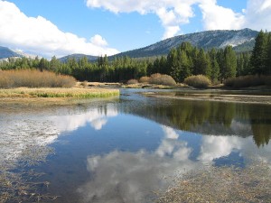
Tuolumne River as it passes through Tuolumne Meadows

A few days before Christmas, I got up early to catch a plane to San Diego. Before I left my apartment, I drank Tuolumne River water from the tap in my apartment, water from Yosemite, four or five hour drive east of where I was standing. As soon as I got to San Diego, my mom picked me up and drove me to my dad’s house so that we could pile into another car and drive two and a half hours to Palm Desert to visit friends.

Before we left, I had a drink from my dad’s tap. Strangely I was sipping on water, some of which was from a river way North of San Francisco- the Feather River- where I had just come from. The other part of the well-traveled water I was drinking came from the Colorado River, far to the east of me, making up the southern boundary between California and Arizona, with its watershed far to the North in the Rocky Mountains.

After a drink of the strange not-so-good tasting elixir that is San Diego water, my family and I piled into a car and drove through the arid hills of Southern California, through Escondido and Temecula, through Anza and Pinon Flats, past many dry riverbeds and only a few running rivers, down into the seriously parched land of Palm Desert. That night, as I drank a glass of wine to mellow out from the long journey of the day, I filled a glass with water from the tap- water supplied from the local groundwater of the desert.

Needless to say, if it already hasn’t come across from other things I mentioned, we live in a highly altered waterscape in California. One where water from hundreds and hundreds of miles away makes our lives possible, especially if you live in any of the three large cities of Los Angeles, San Diego, or San Francisco.

So what river are you drinking from everyday? I’ll give a list of some major areas and the major rivers that provide

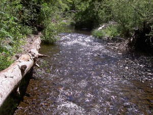
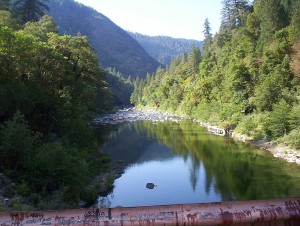
Feather River Crossing at Milsap Bar, Butte County

their water. If I don’t mention a place you’d like to know about, post a comment and I’ll do my best to find out what river supplies that area.

If you live in the city of San Francisco or on the Peninsula in the South Bay, you drink water from the Tuolumne River in Yosemite. In terms of other places in the Bay Area, if you live in the East Bay your water is from the Mokelumne River, from the mountains east of Stockton. If you live in Marin, your water comes mainly from the Russian River, but also from the Eel River.

For those of you who live in Los Angeles, your water comes from the aforementioned Feather River, north of San Francisco, and also the Colorado River, the Owens River, which drains part of the Eastern Sierras, a little groundwater, and don’t forget recycled wastewater. And San Diegans, you drink water, as mentioned before, from the Feather and Colorado Rivers supplemented by a very little bit of local stream and reservoir water.

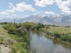
Owens River South of Poverty Hills

Next week, I will tell the story of the first water fieldtrip of the year- going this weekend to watch salmon spawn in the Lagunitas watershed, North of San Fran. Have a great week hatching plots to take over the world this year! 2010!

Tuolumne River and Feather River Pics- licensed under Creative Commons 3.0.

Owens River Pic by Richard E. Ellis