Future Waterscape

...now browsing by category


The Delta: its future

Friday, September 17th, 2010

down in the the Delta- the Sacramento

So yes, my friends, we have learned a lot about the Delta in these last two weeks. What a delta is supposed to be: the marshy capillaries that connect freshwater rivers to oceans and bay. And what our Delta is:  a fragile, strangely beautiful place that has undergone a radical, human transformation and whose future rests in the hands of every Californian.

Most people recognize that if we are going to move in a healthy direction for the Delta, many different groups of people will have to work together: farmers, environmentalists, urban folk, fisherman, residents, and recreational enthusiasts. Without working together and without support, the Delta will surely collapse; ecologically, culturally, physically, etc.

One of the more controversial plans you are certain to hear a lot about in the future is the possibility of a peripheral canal. What is it? It is an engineered canal that would extract water from rivers north of the Delta, bypassing the Delta altogether, so that water can travel unimpeded to the South.

There are many, many opinions about the canal. I, myself, am not convinced that building a several billion dollar canal is the way to go. Some, such as the Public Policy Institute of California, say that a peripheral canal will take pressure off the Delta environmentally and that long term, it is a more cost effective method because global warming and earthquakes are likely to make maintaining levees costly and nearly impossible.
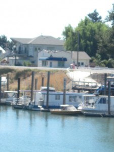
Others say that a peripheral canal may make the Delta’s situation only worse- possibly extracting more water from its already low levels, ruining farmers’ livelihoods and making water quality in the Delta worse.

While it’s a bit hard to decipher who’s who in this highly political battle, I would not support the canal unless there were guarantees that protecting the Delta’s ecosystem is a mandatory part of its plan and also studies that show it is truly the best option for our watery health. I am inherently distrustful of plans that make California’s waterways even more manmade and controlled and also, have the potential to make a few people wealthier. When it becomes a hot topic again, please, dear reader, rely on your critical reasoning to decide what to support.

Besides engineering, the future of the Delta will be determined by our awareness and support of it. Crucial to our watery health and circulation, the Delta is important beyond all of our needs and demands on it. Locally and statewide, agreements can be made to honor the functions of the Delta and its inhabitants as well as support our human needs. Those of us in the Bay Area have the opportunity to work on the ground, helping to restore the Delta piece by small piece. (see below for restoration opportunities)

a delta in our future....

And in every corner of California, we need to recognize that our relationship to water will determine the fate of the Delta. The less we use, the more we recycle in innovative and energy-efficient ways, the more we contribute to the survival of our Delta, our watery heart.

For more information about the Delta or to get involved, go visit and see for yourself or look at:

Cosumnes River Preserve– large scale restoration of the Sacramento-San Joaquin Delta. A great place to learn about the original, natural functions of rivers on the valley floor as well as how humans can coexist with the natural functions of the Delta.

Discover the Delta Foundation- “an unbiased perspective” on the Delta

Restore the Delta– local Delta organization dedicated to the agricultural, ecological, and recreational health of the Delta.

Stay tuned next week for a visit  to Cosumnes River Preserve, an incredible example what the Delta used to look like and also, what it could look like in the future.

Miller Creek Restoration

Thursday, March 25th, 2010

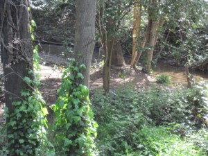
Miller Creek hidden in English Ivy

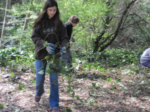
On a sunny morning this week, we pulled up to a thin walkway, between suburban houses, that entered the cool shade of Miller Creek. Located just off the 101 off Lucas Valley Road in Marin County, at this reach in its meanderings, Miller Creek and its riparian corridor pass just behind a school. Soon, sixth graders from Miller Creek Middle School would pour out of class and into the trees behind their school to continue a tradition of restoring and taking care of their local creek.

A collaboration between Marin County Stormwater Pollution Program (MCSTOPP) and Students and Teachers Restoring A Watershed (STRAW), these creek restoration days are the hands-on part of an educational effort to connect “riparian restoration concepts to stormwater pollution prevention and to creek habitat protection.” After in-class learning, the students come to the creek to remove invasive plants, non-native plants that aggressively take-over other plants’ habitats, to plant native plants that will provide habitat for animals and prevent erosion, and to stabilize creek walls.

The night before coming to Miller Creek, I read up on stormwater pollution and riparian restoration and learned some interesting facts. The most enlightening was that preventing stormwater pollution is especially important because almost all stormwater leads directly to creeks, the Bay, and the ocean. Water that goes down a drain in your house goes to a treatment plant before entering a natural body of water. Not stormwater. In other words, any litter, chemicals, or soap that go into the gutter, go into your local creeks and the ocean. So, it is super important to prevent anything but pure stormwater from flowing into storm drains.

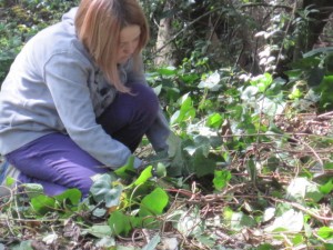
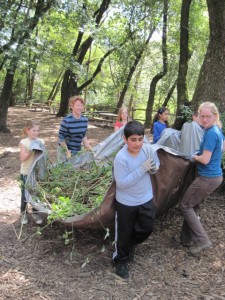
As the first classes poured into the trees, the sixth graders were split up to work on different projects. My colleague Vivien, who works with MCSTOPP, and I led our first group of eight students to a clearing upstream of the other groups. English Ivy, an invasive plant that is home only to rats, and is so noxious that no animals eat it, covered the area. Vivien instructed the students to kneel on the ground and slowly and carefully pull the Ivy from the ground, trying to get as much of the root as possible so that it wouldn’t return. He then demonstrated how to use two tools, a weed-puller and a mattock, a small pick, that would help yank the roots of any stronger plants up. And then he set us loose.

Sounds easy enough right? During that first group I got an idea of why English Ivy is an invasive plant. An interconnected tangle of plants that roots its branches wherever it can and can have its main root yards away from the ends of its vines, I could see why they instruct the kids to be slow and careful about work. My first instinct was to attack and rip at the tangled monstrosity of plants in front of me. Just trying to find where a branch went into the ground was challenging. But reigning in my impatience and wanting to be a good roll-model, I figured out a method of pulling that seemed to be most effective. Patience. Working with what’s right in front of you. Being content with removing one small root at a time.

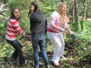
Throughout the day, Vivien and I worked with five different groups of sixth-graders, watching as the Ivy’s borders retreated. At the end of the day, the truck was filled with around three cubic yards of Himalayan blackberry and Ivy from everyone’s effort. It was rewarding work.  And especially rewarding to watch different students work together to get massive trunks of Ivy from the ground. My personal favorite was watching as a group of girls, a few of them in pretty slip-on shoes and pink flip-flops hunkered down in the dirt, using their collective strength to pull out branches of Ivy we’d been having trouble with all day long. It was a joy to watch a small group of humans band together to take care of the environment, to be connected to it.

As I watched five different groups of kids approach the mass of Ivy in the same way I had (wanting to rip through the tangle impatiently and play tug-of-war with long vines that would break without giving their roots up), I began to see Ivy as the perfect metaphor for humans’ relationship with the environment at the moment. An interconnected tangle of problems that will not take a quick fix, the Ivy, like our ecosystem problems, requires patience, working with what is right in front of us, satisfaction with small victories, and a commitment to removing the root of the problem, not ripping at branches haphazardly and mindlessly. One Ivy root at a time.

Thank you to MCSTOPP and STRAW for your amazing work! And thank you to Ericka from the California Water Quality Control Board for letting me tag along!

California’s Waterscape: then and now.

Thursday, December 10th, 2009

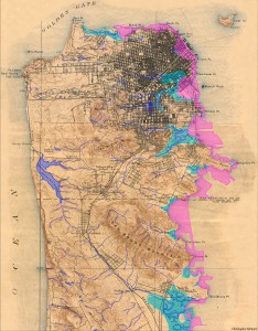
TopoSFCreeksAs I mention in the Author section, this project was partly inspired by a meeting with Islais Creek, a forgotten river of San Francisco. Beside the creek, I saw a map that showed the major historical and strangely absent rivers of San Francisco. Seeing that map was a powerful experience. Almost like I’d been given a gift and had it taken away in the same moment. But as I continued to wonder where these bodies of water went, I realized that the gift of those rivers had not been taken away completely. They were just under my feet. Somewhere buried. And that changed my whole experience of walking around San Francisco.

Now, I pay attention to water when I see it and watch where it’s going. I seek out the sound of our ancient rivers gurgling under the Department of Public Works sewer manholes (they are there!). I imagine digging through layers of cement, through old abandoned ships and other miner rubble that filled in the bay, to arrive at the mouth of the ancient rivers that continue to carry San Francisco’s minerals and freshwater into the salty bay and Pacific.

The next water map that changed the way I see things is a map of California’s waterscape before Europeans came. It, too, has features I don’t recognize. For instance, a giant lake at the end of the Central Valley, called Tulare Lake, that is bigger than Lake Tahoe. Only a dry lake bed, erased from most modern maps, survives. Also missing, are giant stretches of freshwater marsh that stretch all the way from North of the Bay Area through the Sacramento Delta, covering the Central Valley to its southern end. The San Joaquin River regularly left its banks and flooded the Central Valley during the spring and winter, creating a vast and fertile freshwater marsh. Saltwater marshes are also absent from the mouths of rivers in Northern and Southern California. Marshes that supported Tule Elk, beaver, and Grizzly Bears, a bear that was so common and abundant it became our state animal.

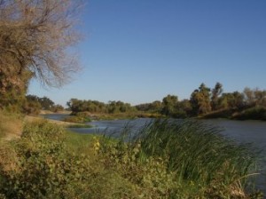
Modern maps of California’s waterscape are very different from the pre-European one. Looking at a map today youSan Joaquin River would see two of our major rivers, the Sacramento and the San Joaquin, as solid blue lines, but in reality, the map should show dotted lines; to show all the stretches that have been dewatered, being diverted to other uses such as drinking water in Southern California and farming in the Central Valley.

Today, in a state with an incredible amount of rivers and watersheds, 20,000 miles of rivers forming 60 major watersheds, only one watershed, the Smith River’s, is free of dams. And modern maps include strange new bodies of water, reservoirs and lakes, some of which used to be valleys that were flooded for water storage. The Salton Sea is great example of a ‘new’ body of water. The historical map shows the Salton Sink, an extremely salty, low-lying area that flooded from time to time, but was generally dry. Now, salty Colorado River water and farm run-off collect to create the Salton Sea, luckily, at the same time creating a habitat for water birds that were displaced by development on the Southern California coast.

Seeing the original waterscape of California is a blessing and a curse. It is incredible to understand how California looked and where water naturally wants to travel. To know about ancient bodies of water I didn’t know existed. At the same time, it’s hard to be given a precious gift and have it taken away. It is heartbreaking that I never got to see California at its most wild and abundant and flowing.

But on the other side of grief, there is acceptance and possibility. Ok, so our landscape, water and otherwise, has been irrevocably changed. For a moment, let’s change our perspective and acknowledge how incredible it is that humans can alter their environment in such significant ways. In the 1940s and 50s, when most of California’s major water infrastructure was being built, there was a feeling that human know-how and engineering could overcome any obstacle that nature threw its way. The only problem is, we succeeded in overcoming nature.  And nature is the source of our water, our food, our air, our lives.

And so here we are. In a time where we realize, we must work with nature, not overcome it. Here lies possibility. We cannot go back to the map of California’s waterscape past. But we can use it to understand where water naturally wants to flow, and how to support water in bringing us its abundance. Instead of forcing water against its will to go where we want it, we can observe and guide it to where it will naturally do the most work for ecosystems and by extension, for us. We can coax it back into wetlands, the nurseries of wildlife and the most biologically productive places on earth. Just as we can coax it to saturate our farmland with fertility. Just as we can harvest and recycle water directly where it falls in our urban areas.

If in one century we could alter the landscape in such a profound way, we can do it again. Only this time, we’ll humbly remember who the hand is that feeds us.

Sources:

Introduction to Water in California, by David Carle

KQED documentary, Saving the Bay

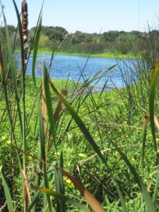
Header Image: by Gary Stolz, public domain photo from the US Fish and Wildlife Service archive.

River Image: present day San Joaquin River, public domain from the California Central Valley Water Board